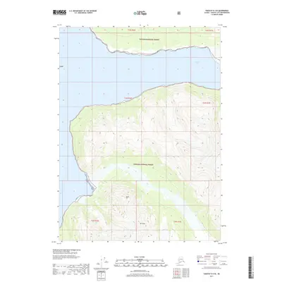
2017 Map of Yakutat D-4 SE
USGS Topo · Published 2017About this map
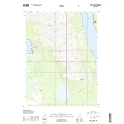
Nunatak Fiord dominates the upper half of this coastal landscape, carved deep into the wilderness of the Tongass National Forest. This sub-arctic terrain is defined by extreme relief, where the peaks of Mt Unana and South Mtn rise sharply from the water's edge. Along the western shoreline, Seal Bay provides a sheltered cove amidst the steep topography. The map illustrates a transitional glacial environment where the sea meets the forest, showing a landscape almost entirely devoid of human infrastructure, save for the foundational survey lines that segment this roadless portion of the Yakutat City and Borough. It serves as a precise record of coastal contours and elevations in one of the most secluded reaches of the Alaskan panhandle.
Find a feature on this map
11 named features on this map. Tap any name to fly to it.
Don’t see what you’re looking for? This feature index may not catch every label — zoom into the map to look around manually.
Map Details
Editions of this 2017 Yakutat D-4 SE Map
This is the sole edition of this map. No revisions or reprints were ever made.
Other maps of this area

1951 · Yakutat
USGS Topo · 1:250,000

1959 · Yakutat C-3
USGS Topo · 1:63,360

1959 · Yakutat D-3
USGS Topo · 1:63,360

1959 · Yakutat D-4
USGS Topo · 1:63,360

1959 · Yakutat C-4
USGS Topo · 1:63,360

1959 · Yakutat
USGS Topo · 1:250,000
1997 · Yakutat C-4
USGS Topo · 1:63,360
2017 · Yakutat D-4 SW
USGS Topo · 1:25,000
2017 · Yakutat C-4 NE
USGS Topo · 1:25,000
2017 · Yakutat C-4 NW
USGS Topo · 1:25,000