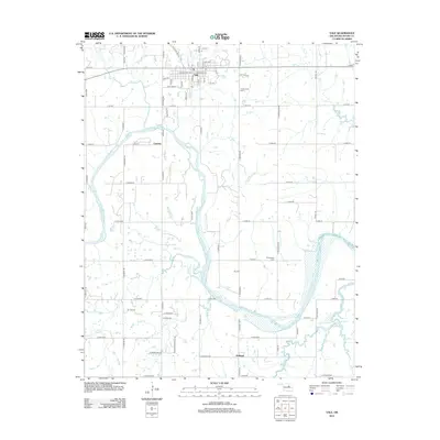
2012 Map of Yale
USGS Topo · Published 2012About this map
Yale anchors the northern portion of this Payne County landscape, serving as a hub where Old State Hwy 51 and the local street grid met during the early 21st century. The terrain is defined by the winding course of the Cimarron River, which carves through the center and southeast, fed by a network of drainage systems including Turkey Cr, Skull Cr, and Euchee Cr. The presence of Oil Field Rd and several marked Oil WL sites highlights the region's enduring connection to energy extraction. Smaller settlements such as Schlegel and Cartoco are recorded alongside historic burial grounds like Underwood Cem and Greenwood Cem, providing critical landmarks for genealogists and local historians tracking the development of these Oklahoma communities between the river bends.
Find a feature on this map
79 named features on this map. Tap any name to fly to it.
Don’t see what you’re looking for? This feature index may not catch every label — zoom into the map to look around manually.
Map Details
Editions of this 2012 Yale Map
This is the sole edition of this map. No revisions or reprints were ever made.
Other maps of this area

1908 · Agra
USGS Topo · 1:62,500

1929 · Yale
USGS Topo · 1:62,500

1929 · Ripley
USGS Topo · 1:62,500

1931 · Drumright
USGS Topo · 1:62,500

1932 · Yale
USGS Topo · 1:62,500

1932 · Ripley
USGS Topo · 1:62,500

1954 · Oklahoma City
USGS Topo · 1:250,000

1955 · Enid
USGS Topo · 1:250,000

1957 · Oklahoma City
USGS Topo · 1:250,000

1958 · Enid
USGS Topo · 1:250,000