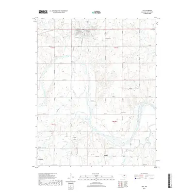
2018 Map of Yale
USGS Topo · Published 2018About this map
Cimarron River bends through the center of this Payne County landscape, defining the topography between Yale and the northern edge of Cushing. The settlement of Yale is the primary hub, showing a grid of streets such as W Ft Worth and E Chicago Ave just north of the 11905 Reservoir. To the south, the map documents smaller localities like Schlegel and Cartoco, alongside the railway-aligned community of Gano. Rural life is marked by numerous family-history landmarks, including Underwood Cem and Greenwood Cem. The drainage network is particularly dense here, with Skull Creek, Salt Creek, and Euchee Creek cutting through the terrain toward the main river channel. This survey provides a clear view of the section-line road system, such as E Deep Rock Rd and Log Cabin Rd, which organized the Oklahoma territory into its modern agricultural and residential form.
Find a feature on this map
50 named features on this map. Tap any name to fly to it.
Don’t see what you’re looking for? This feature index may not catch every label — zoom into the map to look around manually.
Map Details
Editions of this 2018 Yale Map
This is the sole edition of this map. No revisions or reprints were ever made.
Other maps of this area

1908 · Agra
USGS Topo · 1:62,500

1929 · Yale
USGS Topo · 1:62,500

1929 · Ripley
USGS Topo · 1:62,500

1931 · Drumright
USGS Topo · 1:62,500

1932 · Yale
USGS Topo · 1:62,500

1932 · Ripley
USGS Topo · 1:62,500

1954 · Oklahoma City
USGS Topo · 1:250,000

1955 · Enid
USGS Topo · 1:250,000

1957 · Oklahoma City
USGS Topo · 1:250,000

1958 · Enid
USGS Topo · 1:250,000