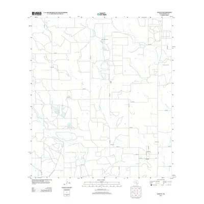
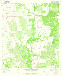
2013 Map of Yancey
USGS Topo · Published 2013About this map
Yancey and its surrounding ranchlands are defined by a network of seasonal watercourses and rural roads in this Medina County landscape. The settlement serves as a local hub near Yancey Cem, while family-named landmarks like Hidden Valley Ranch and Hood Ranch reflect the area's agricultural roots. The terrain is marked by subtle rises such as Red Hill and is bisected by the drainages of Tehuacana Cr and W Tehuacana Cr. Resource extraction is evident in the northeast corner at the Taylor-Ina Oil Field, indicating the area's place in the regional energy economy. For genealogists and local historians, the map's placement of the Butts Cem and Styles Cem provides essential spatial context for tracing family histories in this part of Texas. These details, alongside the distinct courses of Seco Cr and Squirrel Cr, offer a clear picture of the region's rural development.
Find a feature on this map
33 named features on this map. Tap any name to fly to it.
Don’t see what you’re looking for? This feature index may not catch every label — zoom into the map to look around manually.
Map Details
Editions of this 2013 Yancey Map
This is the sole edition of this map. No revisions or reprints were ever made.
Other maps of this area

1928 · Frio Town
USGS Topo · 1:62,500

1954 · San Antonio
USGS Topo · 1:250,000

1956 · Sabinal
USGS Topo · 1:62,500

1956 · New Fountain
USGS Topo · 1:62,500

1957 · San Antonio
USGS Topo · 1:250,000
1964 · Moore
USGS Topo · 1:24,000
1964 · Wilson Ranch
USGS Topo · 1:24,000
1964 · Biry
USGS Topo · 1:24,000

1964 · Yancey
USGS Topo · 1:24,000
1970 · Murphy School
USGS Topo · 1:24,000