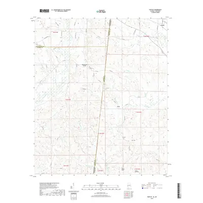
2018 Map of Yantley
USGS Topo · Published 2018About this map
Yantley and Cyril sit near the winding state border where Mississippi and Alabama meet, a landscape defined by an intricate network of creeks and ridges. The terrain rises to distinct heights at Bill Mtn and along Hog Wallow Ridge, which separate the various tributaries feeding the Bogue Chitto and Okatuppa Cr. For those tracing local history, the map identifies several rural landmarks including Mount Zion Cem, Tims Cem, and McLendon Cem, which are linked by a web of county roads like Co Rd 464 and Thrush Rd.
Find a feature on this map
70 named features on this map. Tap any name to fly to it.
Don’t see what you’re looking for? This feature index may not catch every label — zoom into the map to look around manually.
Map Details
Editions of this 2018 Yantley Map
This is the sole edition of this map. No revisions or reprints were ever made.
Other maps of this area

1921 · Meridian
USGS Topo · 1:48,000

1923 · Meridian
USGS Topo · 1:62,500

1953 · Meridian
USGS Topo · 1:250,000

1957 · Meridian
USGS Topo · 1:250,000

1957 · Quitman
USGS Topo · 1:62,500

1965 · Meridian
USGS Topo · 1:250,000

1971 · Vimville
USGS Topo · 1:24,000

1974 · Yantley
USGS Topo · 1:24,000

1974 · Ward
USGS Topo · 1:24,000

1974 · Lisman
USGS Topo · 1:24,000