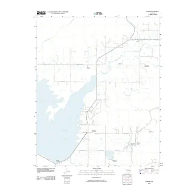
2010 Map of Yanush
USGS Topo · Published 2010About this map
The Old Choctaw Indian Council House serves as a historic focal point in this portion of Latimer County, situated near the Old Town-Tuskahoma Cemetery. This landscape is defined by the expansive waters of Sardis Lake, which occupies the western half of the quadrangle, fed by Buffalo Creek and Jackfork Creek. The small settlement of Yanush sits at a crossroads in the central part of the map, surrounded by several family-named burial grounds including Hokit Cemetery, King Cemetery, and Trowbridge Cemetery. Topography is varied, with elevations rising toward Snakie Hill and descending to the creek beds of Anderson Creek and Boggs Hollow Creek. Water management structures like the Nanih Waiya Lake Dam and Clayton Lake Dam highlight the engineered nature of the contemporary hydrology in this part of Oklahoma.
Find a feature on this map
35 named features on this map. Tap any name to fly to it.
Don’t see what you’re looking for? This feature index may not catch every label — zoom into the map to look around manually.
Map Details
Editions of this 2010 Yanush Map
This is the sole edition of this map. No revisions or reprints were ever made.
Other maps of this area

1901 · Tuskahoma
USGS Topo · 1:125,000

1908 · Tuskahoma
USGS Topo · 1:125,000

1909 · Tuskahoma
USGS Topo · 1:125,000

1940 · Red Oak
USGS Topo · 1:62,500

1943 · Red Oak
USGS Topo · 1:62,500

1950 · Mcalester
USGS Topo · 1:250,000

1962 · McAlester
USGS Topo · 1:250,000

1965 · McAlester
USGS Topo · 1:250,000

1971 · Yanush
USGS Topo · 1:24,000

1971 · Kiamichi
USGS Topo · 1:24,000