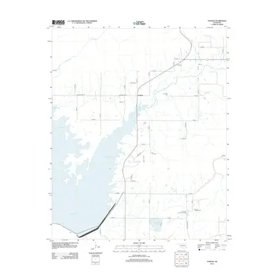
2013 Map of Yanush
USGS Topo · Published 2013About this map
The Old Choctaw Indian Council House anchors the southern portion of this region, serving as a significant cultural landmark near the Old Town Tuskahoma Cem. The landscape is dominated by the expansive waters of Sardis Lake, which defines the western terrain, while the smaller Lake Nanih Waiya sits further east. The settlement of Yanush lies at a crossroads in the north-central area, surrounded by a network of rural roads such as Anderson Creek Rd and Sardis Acres Rd. This 2013 survey illustrates a rural community shaped by its proximity to large water bodies and its indigenous heritage, with numerous family and community burial sites scattered throughout, including King Cem, Trowbridge Cem, and Cupco Cem. Waterways like Anderson Cr and Cedar Cr drain the higher elevations, creating a complex geography of ridges and valleys including Boggs Hollow.
Find a feature on this map
45 named features on this map. Tap any name to fly to it.
Don’t see what you’re looking for? This feature index may not catch every label — zoom into the map to look around manually.
Map Details
Editions of this 2013 Yanush Map
This is the sole edition of this map. No revisions or reprints were ever made.
Other maps of this area

1901 · Tuskahoma
USGS Topo · 1:125,000

1908 · Tuskahoma
USGS Topo · 1:125,000

1909 · Tuskahoma
USGS Topo · 1:125,000

1940 · Red Oak
USGS Topo · 1:62,500

1943 · Red Oak
USGS Topo · 1:62,500

1950 · Mcalester
USGS Topo · 1:250,000

1962 · McAlester
USGS Topo · 1:250,000

1965 · McAlester
USGS Topo · 1:250,000

1971 · Yanush
USGS Topo · 1:24,000

1971 · Kiamichi
USGS Topo · 1:24,000