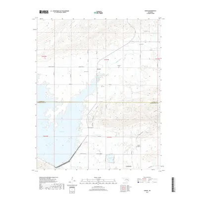
2019 Map of Yanush
USGS Topo · Published 2019About this map
Sardis Lake and the smaller Lake Nanih Waiya dominate the lowland geography along the border of Latimer and Pushmataha Counties. The settlement of Yanush sits at a crossroads in the northern portion of the quadrangle, while Tuskahoma occupies the southern edge, illustrating the rural development patterns of the Ouachita Mountains region. This landscape is marked by numerous family and community burial grounds, including King Cem, Trowbridge Cem, and the Tuskahoma Choctaw Veterans Cem, which underscore the deep tribal and local ancestry of the area. A network of rural roads such as McGuire-Lennon Rd and Co Line Rd weave through a terrain defined by drainages like Buffalo Creek and Anderson Cr, showing the persistent connection between topography and local transit.
Find a feature on this map
49 named features on this map. Tap any name to fly to it.
Don’t see what you’re looking for? This feature index may not catch every label — zoom into the map to look around manually.
Map Details
Editions of this 2019 Yanush Map
This is the sole edition of this map. No revisions or reprints were ever made.
Other maps of this area

1901 · Tuskahoma
USGS Topo · 1:125,000

1908 · Tuskahoma
USGS Topo · 1:125,000

1909 · Tuskahoma
USGS Topo · 1:125,000

1940 · Red Oak
USGS Topo · 1:62,500

1943 · Red Oak
USGS Topo · 1:62,500

1950 · Mcalester
USGS Topo · 1:250,000

1962 · McAlester
USGS Topo · 1:250,000

1965 · McAlester
USGS Topo · 1:250,000

1971 · Yanush
USGS Topo · 1:24,000

1971 · Kiamichi
USGS Topo · 1:24,000