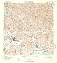
1952 Map of Yauco
USGS Topo · Published 1953About this map
The town of Yauco serves as a central hub on this mid-century survey, flanked by its distinct neighborhoods of Pueblo Norte and Pueblo Sud. The landscape to the south and east is dominated by the sugar industry, centered around the Central Rufina mill and the operations at Playa de Guayanilla along the Bahía de Guayanilla. This coastal economy is linked by the American Railroad of Porto Rico, which traces the shoreline near El Faro and Pta Pepillo.
Find a feature on this map
84 named features on this map. Tap any name to fly to it.
Don’t see what you’re looking for? This feature index may not catch every label — zoom into the map to look around manually.
Map Details
Editions of this 1952 Yauco Map
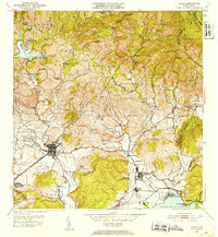
2 editions found
Other maps of this area

1937 · Sabana Grande
USGS Topo · 1:25,000

1938 · Guanica
USGS Topo · 1:30,000

1941 · Sabana Grande
USGS Topo · 1:30,000

1946 · Maricao
USGS Topo · 1:30,000

1946 · Punta Cuchara
USGS Topo · 1:30,000

1946 · Yauco
USGS Topo · 1:30,000

1946 · Monte Guilarte
USGS Topo · 1:30,000

1946 · Punta Verraco
USGS Topo · 1:30,000

1946 · Penuelas
USGS Topo · 1:30,000

1946 · Adjuntas
USGS Topo · 1:30,000