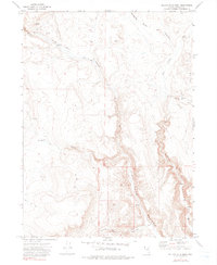
1972 Map of Yellow Hills West
USGS Topo · Published 1990About this map
High Rock Canyon and its network of deeply cut drainages define this portion of northwestern Nevada as it appeared in the early 1970s. This survey records the sparse human presence in a landscape dominated by the Yellow Hills and numerous tributary ravines like Wall Canyon and Pole Canyon. The settlement pattern is characterized by isolated outposts and livestock facilities rather than towns, reflecting the region's enduring ranching heritage. Researchers can identify specific cattle-operation landmarks including Bernards Corrals and Stevens Camp, alongside family-named locations such as the Van Riper Place and Bernard Place. These sites, often situated near vital water sources like Cottonwood Creek or unnamed springs, are linked by a rudimentary network of jeep trails that navigate the high-desert terrain.
Find a feature on this map
16 named features on this map. Tap any name to fly to it.
Don’t see what you’re looking for? This feature index may not catch every label — zoom into the map to look around manually.
Map Details
Editions of this 1972 Yellow Hills West Map
3 editions found
Other maps of this area

1889 · Long Valley
USGS Topo · 1:250,000

1954 · Vya
USGS Topo · 1:250,000

1958 · Vya
USGS Topo · 1:250,000

1962 · Vya
USGS Topo · 1:250,000

1966 · Nut Mountain
USGS Topo · 1:24,000

1966 · Badger Mtn SE
USGS Topo · 1:24,000

1966 · Massacre Creek
USGS Topo · 1:24,000

1972 · Mahogany Mtn
USGS Topo · 1:24,000

1972 · High Rock Lake
USGS Topo · 1:24,000
1972 · Yellow Hills East
USGS Topo · 1:24,000