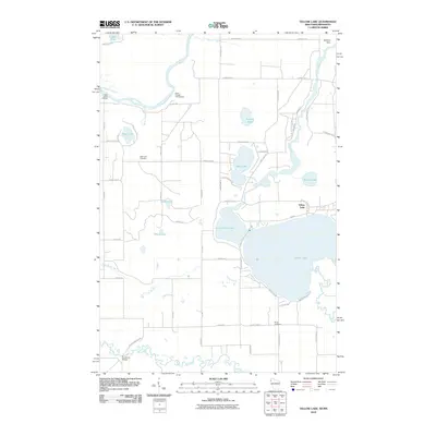
2010 Map of Yellow Lake
USGS Topo · Published 2010About this map
Yellow Lake and its smaller neighbor Little Yellow Lake anchor this 2010 topographic record of Burnett County, Wisconsin. The landscape is defined by its complex hydrology, where the Yellow River flows into the primary lakes before joining the Saint Croix River to the northwest. This riverine system supported various historical crossings and settlements, including Saint Johns Landing and the Ice House Bridge over the Clam River in the south. For local historians, the map preserves the location of Bluff Lake Cemetery and Perida Cemetery, alongside recreational sites like the Sioux Portage Campground. The presence of the Danbury Dam on the Yellow River illustrates the managed water levels that maintain Buffalo Lake and the surrounding wetlands. This quadrangle shows a region where modern county highways and local roads like N Bass Lake Rd follow the contours of a glacial lake-land, weaving between smaller water bodies such as Rahn Lake and Chase Lake.
Find a feature on this map
58 named features on this map. Tap any name to fly to it.
Don’t see what you’re looking for? This feature index may not catch every label — zoom into the map to look around manually.
Map Details
Editions of this 2010 Yellow Lake Map
This is the sole edition of this map. No revisions or reprints were ever made.
Other maps of this area

1949 · Danbury
USGS Topo · 1:48,000

1950 · Webster
USGS Topo · 1:48,000

1950 · Grantsburg
USGS Topo · 1:48,000

1953 · Duluth
USGS Topo · 1:250,000

1953 · Stillwater
USGS Topo · 1:250,000

1955 · Webster
USGS Topo · 1:62,500

1955 · Stillwater
USGS Topo · 1:250,000

1958 · Stillwater
USGS Topo · 1:250,000

1958 · Duluth
USGS Topo · 1:250,000

1962 · Cloverdale
USGS Topo · 1:62,500