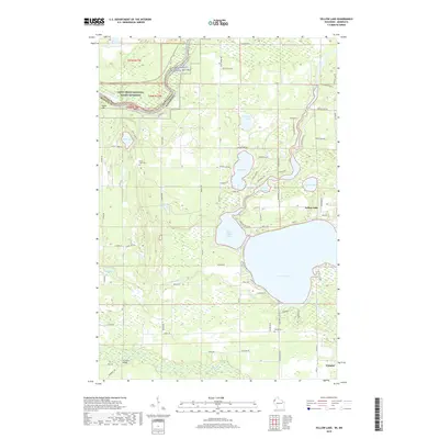
2019 Map of Yellow Lake
USGS Topo · Published 2019About this map
Yellow Lake and the Little Yellow Lake basin dominate this landscape in Burnett County, where the St. Croix Wild and Scenic River forms a natural boundary between Wisconsin and Minnesota. This 2019 survey captures the developed waterfront and the surrounding network of local access roads that define the area's modern character. Local history and genealogy interests are centered on sites such as Bluff Lake Cem and Perida Cem, while the southern portion of the map includes the edge of Webster.
Find a feature on this map
80 named features on this map. Tap any name to fly to it.
Don’t see what you’re looking for? This feature index may not catch every label — zoom into the map to look around manually.
Map Details
Editions of this 2019 Yellow Lake Map
This is the sole edition of this map. No revisions or reprints were ever made.
Other maps of this area

1949 · Danbury
USGS Topo · 1:48,000

1950 · Webster
USGS Topo · 1:48,000

1950 · Grantsburg
USGS Topo · 1:48,000

1953 · Duluth
USGS Topo · 1:250,000

1953 · Stillwater
USGS Topo · 1:250,000

1955 · Webster
USGS Topo · 1:62,500

1955 · Stillwater
USGS Topo · 1:250,000

1958 · Stillwater
USGS Topo · 1:250,000

1958 · Duluth
USGS Topo · 1:250,000

1962 · Cloverdale
USGS Topo · 1:62,500