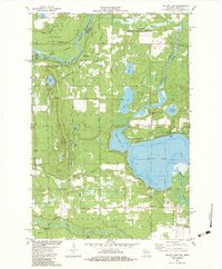
1982 Map of Yellow Lake
USGS Topo · Published 1983About this map
The St Croix River defines the western edge of this 1982 landscape, serving as the border between Minnesota and Wisconsin. Much of the northern terrain is preserved within the St Croix State Park and Governor Knowles State Forest, characterized by dense woodland and significant water bodies like Yellow Lake and its smaller counterpart, Little Yellow Lake. The map reveals a region dedicated to outdoor recreation and conservation, featuring the Danbury Public Hunting Grounds and several specialized routes like the State Trail and a dedicated Snowmobile Trail.
Find a feature on this map
44 named features on this map. Tap any name to fly to it.
Don’t see what you’re looking for? This feature index may not catch every label — zoom into the map to look around manually.
Map Details
Editions of this 1982 Yellow Lake Map
This is the sole edition of this map. No revisions or reprints were ever made.
Other maps of this area

1949 · Danbury
USGS Topo · 1:48,000

1950 · Webster
USGS Topo · 1:48,000

1950 · Grantsburg
USGS Topo · 1:48,000

1953 · Duluth
USGS Topo · 1:250,000

1953 · Stillwater
USGS Topo · 1:250,000

1955 · Webster
USGS Topo · 1:62,500

1955 · Stillwater
USGS Topo · 1:250,000

1958 · Stillwater
USGS Topo · 1:250,000

1958 · Duluth
USGS Topo · 1:250,000

1962 · Cloverdale
USGS Topo · 1:62,500