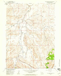
1958 Map of Yellowstone Ranch
USGS Topo · Published 1959About this map
Yellowstone Ranch and other remote outposts like Arthur Ranch and Henton Ranch anchor this landscape in Fremont County, Wyoming, as it was surveyed for the Missouri River Basin development program. The terrain is defined by a complex network of ephemeral drainages including Government Slide Draw, Hays Draw, and Shearing Pen Draw, which cut toward the primary course of Beaver Creek. To the south, a group of Mines suggests the mineral interests of the era, situated near the Proposed Alignment of a roadway cutting through the foothills. The dramatic topography culminates along the Beaver Rim, where Devils Gap Spring provides a rare water source in the high desert environment. This survey captures the ranching and resource-extraction footprint in the late 1950s, detailing a period before modern infrastructure further altered the rugged paths through Hall Creek and Cottonwood Creek.
Find a feature on this map
21 named features on this map. Tap any name to fly to it.
Don’t see what you’re looking for? This feature index may not catch every label — zoom into the map to look around manually.
Map Details
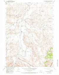
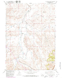
Editions of this 1958 Yellowstone Ranch Map
3 editions found
Other maps of this area

1953 · Ninemile Hill
USGS Topo · 1:24,000

1953 · Bringolf Ranch
USGS Topo · 1:24,000

1953 · Sweetwater Station
USGS Topo · 1:24,000

1953 · Sand Draw
USGS Topo · 1:24,000

1953 · Schlichting Mountain
USGS Topo · 1:24,000

1953 · Dishpan Butte
USGS Topo · 1:24,000

1953 · Del Monte Ridge
USGS Topo · 1:24,000

1953 · Yellowstone Ranch
USGS Topo · 1:24,000

1953 · Red Canyon
USGS Topo · 1:24,000

1955 · Lander
USGS Topo · 1:250,000