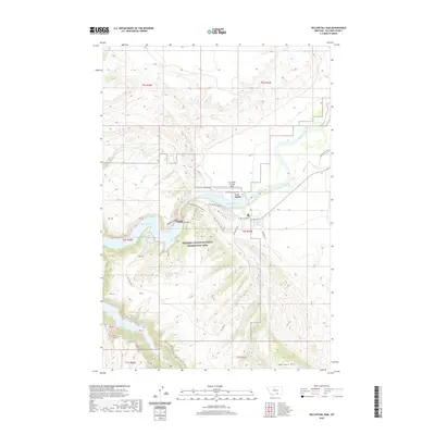
2020 Map of Yellowtail Dam
USGS Topo · Published 2020About this map
Fort Smith serves as the primary hub in this Big Horn County landscape, situated where the Bighorn River emerges from its dramatic canyon. The massive engineering of the Yellowtail Dam creates the expansive Bighorn Lake, which dominates the central topography and provides the foundation for the Bighorn Canyon National Recreation Area. This modern infrastructure contrasts with the historic path of the Bozeman Trl, which traces through the eastern hills, marking an era of overland migration that predates the valley's industrial transformation.
Find a feature on this map
43 named features on this map. Tap any name to fly to it.
Don’t see what you’re looking for? This feature index may not catch every label — zoom into the map to look around manually.
Map Details
Editions of this 2020 Yellowtail Dam Map
This is the sole edition of this map. No revisions or reprints were ever made.
Other maps of this area

1894 · St. Xavier
USGS Topo · 1:125,000

1901 · St. Xavier
USGS Topo · 1:125,000

1915 · Spenceville
USGS Topo · 1:31,680

1954 · Billings
USGS Topo · 1:250,000

1954 · Hardin
USGS Topo · 1:250,000

1957 · Hardin
USGS Topo · 1:250,000

1957 · Billings
USGS Topo · 1:250,000

1958 · Billings
USGS Topo · 1:250,000

1958 · Hardin
USGS Topo · 1:250,000

1964 · Peyote Point
USGS Topo · 1:24,000