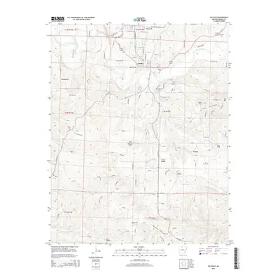
2014 Map of Yellville
USGS Topo · Published 2014About this map
Crooked Creek winds through the heart of the Ozarks in this Marion County landscape, anchoring the neighboring settlements of Yellville and Summit. The area's topography is defined by significant landmarks such as Standing Rock and the Ralph Natural Bridge, which sits north of the Ralph community. Local history is deeply embedded in the rural surroundings, evidenced by a network of family and community burial grounds including Wickersham Cem and Nanny Cem. The southern reach of the map transitions into the drainage basins of Rush Cr and Barren Fork, where the Freck Lookout Tower stands as a prominent vantage point over the timbered hills. This survey documents the modern road network, from established routes like Us-62 W to the winding gravel paths of Rocking Chair Ln and Pebble Creek Ln, illustrating the continued habitation of long-standing hamlets like Cowan.
Find a feature on this map
135 named features on this map. Tap any name to fly to it.
Don’t see what you’re looking for? This feature index may not catch every label — zoom into the map to look around manually.
Map Details
Editions of this 2014 Yellville Map
This is the sole edition of this map. No revisions or reprints were ever made.
Other maps of this area

1893 · Yellville
USGS Topo · 1:125,000

1903 · Yellville
USGS Topo · 1:125,000

1905 · Yellville
USGS Topo · 1:125,000

1929 · Yellville
USGS Topo · 1:125,000

1945 · Harrison
USGS Topo · 1:250,000

1949 · Harrison
USGS Topo · 1:250,000

1954 · Harrison
USGS Topo · 1:250,000

1958 · Harrison
USGS Topo · 1:250,000

1964 · Harrison
USGS Topo · 1:250,000
1966 · Cozahome
USGS Topo · 1:24,000