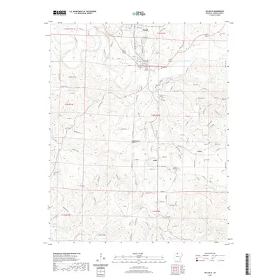
2020 Map of Yellville
USGS Topo · Published 2020About this map
The Marion County Courthouse stands as the central landmark of Yellville, surrounded by a network of local streets including Town St and Panther Ave. This Ozark landscape is defined by the winding course of Crooked Creek, which snakes through the northern half of the quadrangle. To the north, the town of Summit sits near the upper reaches of E Prong Town Br, while small outlying communities like Ralph and Cowan are found further south and east.
Find a feature on this map
144 named features on this map. Tap any name to fly to it.
Don’t see what you’re looking for? This feature index may not catch every label — zoom into the map to look around manually.
Map Details
Editions of this 2020 Yellville Map
This is the sole edition of this map. No revisions or reprints were ever made.
Other maps of this area

1893 · Yellville
USGS Topo · 1:125,000

1903 · Yellville
USGS Topo · 1:125,000

1905 · Yellville
USGS Topo · 1:125,000

1929 · Yellville
USGS Topo · 1:125,000

1945 · Harrison
USGS Topo · 1:250,000

1949 · Harrison
USGS Topo · 1:250,000

1954 · Harrison
USGS Topo · 1:250,000

1958 · Harrison
USGS Topo · 1:250,000

1964 · Harrison
USGS Topo · 1:250,000
1966 · Cozahome
USGS Topo · 1:24,000