
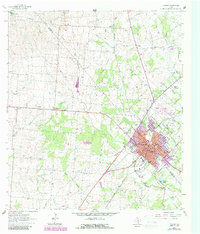
1963 Map of Yoakum
USGS Topo · Published 1964About this map
Yoakum anchors this early 1960s survey, straddling the Lavaca Co De Witt Co line as a hub for the Southern Pacific railroad. The town's grid is dense with social and civic institutions, including St Joseph High Sch, Stephen F Austin Sch, and Memorial Hospital. Beyond the corporate limits, the landscape transitions into a mosaic of small rural communities like Pearl City, Petersville, and Adel.
Find a feature on this map
50 named features on this map. Tap any name to fly to it.
Don’t see what you’re looking for? This feature index may not catch every label — zoom into the map to look around manually.
Map Details
Editions of this 1963 Yoakum Map
2 editions found
Other maps of this area

1953 · Seguin
USGS Topo · 1:250,000

1958 · Seguin
USGS Topo · 1:250,000

1959 · Hochheim
USGS Topo · 1:24,000

1959 · Hamon
USGS Topo · 1:24,000

1960 · Concrete
USGS Topo · 1:24,000

1962 · Edgar
USGS Topo · 1:24,000

1962 · Terryville
USGS Topo · 1:24,000

1963 · Sweet Home
USGS Topo · 1:24,000

1965 · Wied
USGS Topo · 1:24,000
1965 · Shiner
USGS Topo · 1:24,000