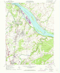
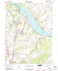
1964 Map of York Haven
USGS Topo · Published 1973About this map
Susquehanna River dominates this landscape, where industrial development and historical landmarks meet along the banks of Conewago Falls. Large islands like Brunner Island and Haldeman Island sit in the river's path, with the Penn Central rail lines tracking the water on both sides. The map captures a moment of growth for communities like Mount Wolf and Manchester, showing the expansion of residential streets and schools such as Northeastern High Sch. Along the Codorus Creek, the presence of the Codorus Furnace speaks to the region's early industrial roots, while active Locust Grove Quarries near Bainbridge highlight the mid-century mineral economy. The area is a network of small hamlets and local infrastructure, from the Water Tank in York Haven to the Community Chapel and Mundis Mill, illustrating a transition from traditional rural mill sites to modern utilities and pipelines.
Find a feature on this map
79 named features on this map. Tap any name to fly to it.
Don’t see what you’re looking for? This feature index may not catch every label — zoom into the map to look around manually.
Map Details
Editions of this 1964 York Haven Map
5 editions found
Other maps of this area

1906 · New Cumberland
USGS Topo · 1:62,500

1908 · Middletown
USGS Topo · 1:62,500

1908 · York
USGS Topo · 1:62,500

1910 · York
USGS Topo · 1:62,500

1920 · Hanover
USGS Topo · 1:62,500

1922 · Hanover
USGS Topo · 1:62,500

1943 · New Cumberland
USGS Topo · 1:62,500

1943 · Middletown
USGS Topo · 1:62,500

1948 · Baltimore
USGS Topo · 1:250,000

1950 · Harrisburg
USGS Topo · 1:250,000