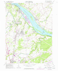
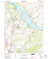
1964 Map of York Haven
USGS Topo · Published 1977About this map
The Susquehanna River dominates this landscape, its wide channel punctuated by substantial landforms like Brunner Island and Haldeman Island. Along the western bank, the industrial and residential character of York Haven, Mount Wolf, and Manchester reflects the development patterns of the mid-20th century. The Penn Central rail line tracks the river's edge, serving as a corridor for the many industrial sites, including numerous quarries near Bainbridge and Billmeyer. This 1972 photorevised edition records the expansion of infrastructure such as the widespread pipelines crossing the river valley and the emergence of suburban developments like Conewago Heights and Woodland View. Local heritage is anchored by sites like Codorus Furnace and several family burying grounds, including Haldeman Cem and Goods Cem, which suggest the area's deep agricultural and industrial roots.
Find a feature on this map
75 named features on this map. Tap any name to fly to it.
Don’t see what you’re looking for? This feature index may not catch every label — zoom into the map to look around manually.
Map Details
Editions of this 1964 York Haven Map
5 editions found
Other maps of this area

1906 · New Cumberland
USGS Topo · 1:62,500

1908 · Middletown
USGS Topo · 1:62,500

1908 · York
USGS Topo · 1:62,500

1910 · York
USGS Topo · 1:62,500

1920 · Hanover
USGS Topo · 1:62,500

1922 · Hanover
USGS Topo · 1:62,500

1943 · New Cumberland
USGS Topo · 1:62,500

1943 · Middletown
USGS Topo · 1:62,500

1948 · Baltimore
USGS Topo · 1:250,000

1950 · Harrisburg
USGS Topo · 1:250,000