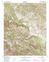
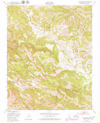
1948 Map of York Mountain
USGS Topo · Published 1979About this map
York Mountain towers over the winding drainage basins of the Santa Lucia Range in this late-1940s topographic study. The landscape is defined by the headwaters of Paso Robles Creek and Santa Rita Creek, where the land-use patterns of the era are clearly visible in the isolated schoolhouses and sprawling cattle ranches. Significant rural educational sites like Summit Sch, Oakdale Sch, and Asuncion Sch are positioned along the winding mountain roads, serving as the social anchors for this sparsely populated region.
Find a feature on this map
19 named features on this map. Tap any name to fly to it.
Don’t see what you’re looking for? This feature index may not catch every label — zoom into the map to look around manually.
Map Details
Editions of this 1948 York Mountain Map
5 editions found
Other maps of this area

1897 · San Luis Obispo
USGS Topo · 1:62,500

1897 · Cayucos
USGS Topo · 1:62,500

1900 · San Luis
USGS Topo · 1:125,000

1919 · Paso Robles
USGS Topo · 1:62,500

1919 · Adelaida
USGS Topo · 1:62,500

1932 · Adelaida
USGS Topo · 1:62,500

1937 · Cayucos
USGS Topo · 1:62,500

1942 · Adelaida
USGS Topo · 1:62,500

1942 · San Luis Obispo
USGS Topo · 1:62,500

1943 · Paso Robles
USGS Topo · 1:62,500