
1920 Map of York
USGS Topo · Published 1946About this map
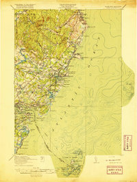
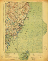
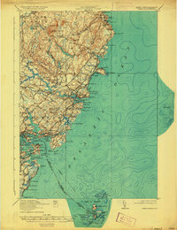
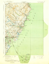
Gerrish Island and the jagged Maine coastline define this 1920 survey of the seacoast, where the Piscataqua River separates Kittery from New Hampshire. The landscape is a network of coastal settlements from Ogunquit down to Rye North Beach, connected by the Post Road and the Atlantic Shore Line Electric Railway. Maritime navigation is central to the area, evidenced by the Whaleback LH and the Isles of Shoals LH offshore.
Find a feature on this map
124 named features on this map. Tap any name to fly to it.
Don’t see what you’re looking for? This feature index may not catch every label — zoom into the map to look around manually.
Map Details
Editions of this 1920 York Map
6 editions found

Other maps of this area

1888 · Newburyport
USGS Topo · 1:62,500

1890 · Newburyport
USGS Topo · 1:62,500

1891 · Biddeford
USGS Topo · 1:62,500

1891 · Berwick
USGS Topo · 1:62,500

1891 · Kennebunk
USGS Topo · 1:62,500

1893 · Kennebunk
USGS Topo · 1:62,500

1893 · Dover
USGS Topo · 1:62,500

1893 · Berwick
USGS Topo · 1:62,500

1893 · York
USGS Topo · 1:62,500

1893 · Biddeford
USGS Topo · 1:62,500