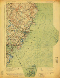
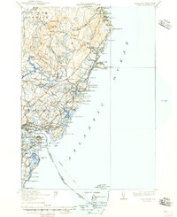
1920 Map of York
USGS Topo · Published 1925About this map
The rocky Maine coastline between Ogunquit and the U S Navy Yard defines this coastal survey, documented shortly after the First World War. The landscape is a network of maritime navigation and early transportation, featuring prominent landmarks like Whaleback LH and the remote Boon Island LH. Inland, the terrain rises toward Mt Agamenticus and the York Woods, while the Atlantic Shore Electric Railway and the Boston and Maine Railroad cut through the countryside, signaling the era's expanding reach. Local life is anchored by small schoolhouses such as the Agamenticus School and Lincoln School, along with the Brixham Grange Hall. The intricate tidal waters of the York River and Spruce Creek are shown in detail, alongside coastal settlements like York Beach and Kittery Point before the modern sprawl of the later twentieth century altered these historic village cores.
Find a feature on this map
106 named features on this map. Tap any name to fly to it.
Don’t see what you’re looking for? This feature index may not catch every label — zoom into the map to look around manually.
Map Details
Editions of this 1920 York Map
6 editions found

Other maps of this area

1888 · Newburyport
USGS Topo · 1:62,500

1890 · Newburyport
USGS Topo · 1:62,500

1891 · Biddeford
USGS Topo · 1:62,500

1891 · Berwick
USGS Topo · 1:62,500

1891 · Kennebunk
USGS Topo · 1:62,500

1893 · Kennebunk
USGS Topo · 1:62,500

1893 · Dover
USGS Topo · 1:62,500

1893 · Berwick
USGS Topo · 1:62,500

1893 · York
USGS Topo · 1:62,500

1893 · Biddeford
USGS Topo · 1:62,500