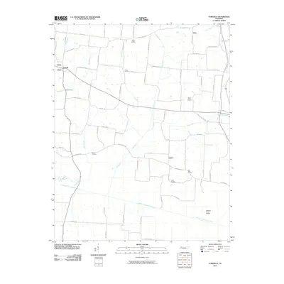
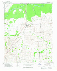
2010 Map of Yorkville
USGS Topo · Published 2010About this map
Yorkville serves as the primary settlement within this rural landscape, situated at the junction of several key local routes including Baseline Rd and Raymond Baker Rd. The area is defined by a dense network of small family cemeteries and rural burial grounds, such as Cowan Cemetery, Hogue Cemetery, and Bells Chapel Cemetery, which are scattered among the agricultural plots. These sites, along with Holly Spring Cemetery and Clear Creek Cemetery, suggest a long-standing pattern of family-centered settlement across the drainage basins of Mud Creek and Cow Creek.
Find a feature on this map
68 named features on this map. Tap any name to fly to it.
Don’t see what you’re looking for? This feature index may not catch every label — zoom into the map to look around manually.
Map Details
Editions of this 2010 Yorkville Map
This is the sole edition of this map. No revisions or reprints were ever made.
Other maps of this area

1951 · Trenton
USGS Topo · 1:24,000

1953 · Dyer
USGS Topo · 1:24,000

1954 · Rutherford
USGS Topo · 1:24,000

1956 · Dyersburg
USGS Topo · 1:250,000

1956 · Blytheville
USGS Topo · 1:250,000

1959 · Blytheville
USGS Topo · 1:250,000
1964 · Brazil
USGS Topo · 1:24,000
1964 · Yorkville
USGS Topo · 1:24,000
1965 · Kenton
USGS Topo · 1:24,000
1965 · Trimble
USGS Topo · 1:24,000