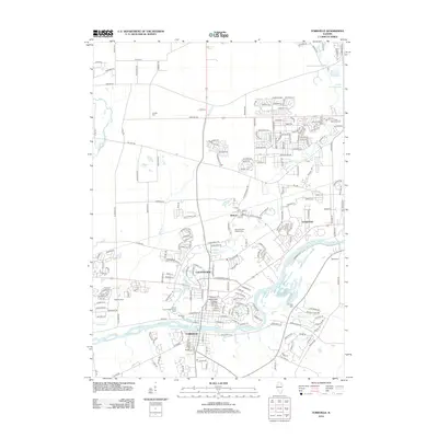
2012 Map of Yorkville
USGS Topo · Published 2012About this map
The Fox River carves through this northern Illinois landscape, serving as the central axis for the burgeoning community of Yorkville. This 2012 survey reveals a complex mix of established agricultural roots and modern suburban expansion. While family-owned tracts like Tukaway Farm and the Glen D Palmer State Game Farm maintain the area's rural heritage, the rise of Countryside and Lynwood signals the intensifying residential footprint near the Aurora Chain of Lakes.
Find a feature on this map
217 named features on this map. Tap any name to fly to it.
Don’t see what you’re looking for? This feature index may not catch every label — zoom into the map to look around manually.
Map Details
Editions of this 2012 Yorkville Map
This is the sole edition of this map. No revisions or reprints were ever made.
Other maps of this area

1925 · Yorkville
USGS Topo · 1:62,500

1932 · Geneva
USGS Topo · 1:62,500

1937 · Sycamore
USGS Topo · 1:62,500

1948 · Geneva
USGS Topo · 1:62,500

1948 · Sandwich
USGS Topo · 1:62,500

1950 · Sandwich
USGS Topo · 1:62,500

1950 · Aurora North
USGS Topo · 1:24,000

1953 · Plattville
USGS Topo · 1:24,000

1953 · Yorkville
USGS Topo · 1:24,000

1953 · Yorkville SE
USGS Topo · 1:24,000