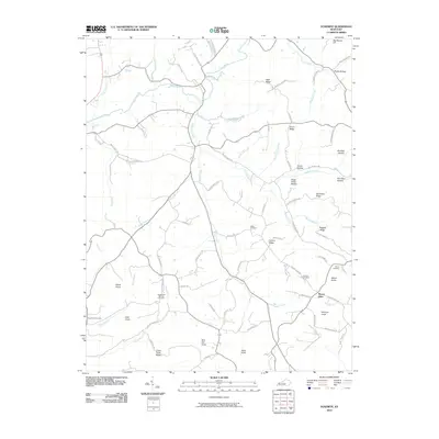
2010 Map of Yosemite
USGS Topo · Published 2010About this map
Mount Olive stands as a central settlement in this portion of Casey County, where the southern Kentucky landscape is defined by a dense network of knobs, ridges, and creek hollows. The Green River meanders across the northern reaches, fed by numerous tributaries including Carpenter Creek and Hungry Creek. This topography created a fragmented settlement pattern, with homesteads and small family farms situated along the narrow valley floors and ridgeline roads. Genealogy researchers will find significant value in the distribution of burial sites, such as the Old Willow Springs Cemetery and Hatter Cemetery, which are often located near historical family landholdings. The terrain is marked by distinctive elevations like Rich Hill Knob and Elliott Knob, while landmarks like Sugar Camp Hollow and Burdick Hollow reflect the traditional naming conventions of the region's early residents. Transportation in this era relied on a web of winding routes like Calvary Ridge Rd and Howe Hollow Rd, which followed the natural contours of the land.
Find a feature on this map
84 named features on this map. Tap any name to fly to it.
Don’t see what you’re looking for? This feature index may not catch every label — zoom into the map to look around manually.
Map Details
Editions of this 2010 Yosemite Map
This is the sole edition of this map. No revisions or reprints were ever made.
Other maps of this area

1935 · Somerset
USGS Topo · 1:62,500

1952 · Ellisburg
USGS Topo · 1:24,000

1952 · Halls Gap
USGS Topo · 1:24,000

1952 · Eubank
USGS Topo · 1:24,000

1952 · Hustonville
USGS Topo · 1:24,000

1952 · Liberty
USGS Topo · 1:24,000

1952 · Yosemite
USGS Topo · 1:24,000

1953 · Phil
USGS Topo · 1:24,000

1953 · Mintonville
USGS Topo · 1:24,000

1954 · Science Hill
USGS Topo · 1:24,000