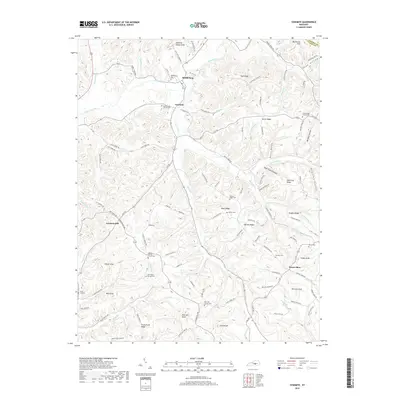
2019 Map of Yosemite
USGS Topo · Published 2019About this map
Middleburg and Yosemite sit along the winding Green River in Casey County, marking a landscape defined by sharp ridges and deep hollows. The settlement pattern follows the drainage of numerous creeks like Knob Lick Cr and Tilford Cr, where small communities and family burial grounds are tucked into the valleys. High points such as High Ridge and Grove Ridge provide natural boundaries, while numerous hilltop markers like Meeting House Knob and Rich Hill Knob serve as local landmarks. The area is dense with historical record-keeping through its many cemeteries and country churches, including the Old Willow Springs Cem and the Rich Hill Church Cem. This landscape shows the enduring layout of rural Kentucky hill country, where narrow roads like Calvary Ridge Rd trace the high ground between the river and its many small branches.
Find a feature on this map
130 named features on this map. Tap any name to fly to it.
Don’t see what you’re looking for? This feature index may not catch every label — zoom into the map to look around manually.
Map Details
Editions of this 2019 Yosemite Map
This is the sole edition of this map. No revisions or reprints were ever made.
Other maps of this area

1935 · Somerset
USGS Topo · 1:62,500

1952 · Ellisburg
USGS Topo · 1:24,000

1952 · Halls Gap
USGS Topo · 1:24,000

1952 · Eubank
USGS Topo · 1:24,000

1952 · Hustonville
USGS Topo · 1:24,000

1952 · Liberty
USGS Topo · 1:24,000

1952 · Yosemite
USGS Topo · 1:24,000

1953 · Phil
USGS Topo · 1:24,000

1953 · Mintonville
USGS Topo · 1:24,000

1954 · Science Hill
USGS Topo · 1:24,000