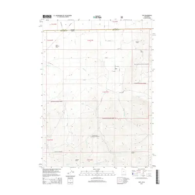
2014 Map of Yost
USGS Topo · Published 2014About this map
Yost sits at the northern edge of the Raft River Mountains, serving as a central hub for ranching and forest access in this high-altitude landscape. The settlement is positioned where George Cr and Johnson Cr descend toward the Upper Raft River Valley, with the Yost Cem located just to the north. Much of the surrounding terrain is managed as the Sawtooth National Forest, reaching high elevations at Mahogany Peaks. The map illustrates a complex network of forest roads and springs, such as Blyth Spring and Mud Spring, which support the livestock and seasonal activities in these uplands. These water sources, along with topographical features like Limekiln Hollow and Browns Canyon, define the working landscape of the borderlands between Box Elder County and Idaho.
Find a feature on this map
42 named features on this map. Tap any name to fly to it.
Don’t see what you’re looking for? This feature index may not catch every label — zoom into the map to look around manually.
Map Details
Editions of this 2014 Yost Map
This is the sole edition of this map. No revisions or reprints were ever made.
Other maps of this area

1954 · Pocatello
USGS Topo · 1:250,000

1954 · Brigham City
USGS Topo · 1:250,000

1958 · Pocatello
USGS Topo · 1:250,000

1958 · Brigham City
USGS Topo · 1:250,000

1959 · Park Valley
USGS Topo · 1:62,500

1959 · Yost
USGS Topo · 1:62,500

1962 · Brigham City
USGS Topo · 1:250,000

1968 · Almo
USGS Topo · 1:24,000

1968 · Jim Sage Canyon
USGS Topo · 1:24,000

1968 · Chokecherry Canyon
USGS Topo · 1:24,000