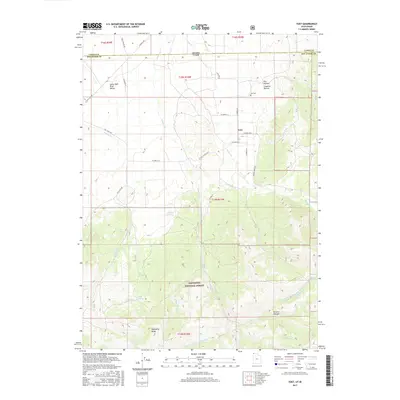
2017 Map of Yost
USGS Topo · Published 2017About this map
Yost serves as the central hub of this high-desert landscape, situated where the Upper Raft River Valley meets the rising slopes of the Sawtooth National Forest. The settlement pattern is defined by a sparse grid of country roads, including George Creek Rd and Yost Rd, which connect remote ranching interests to the Yost Cem. The topography is dominated by the dramatic ascent toward Mahogany Peaks, cut by numerous drainage systems like Johnson Cr and George Cr.
Find a feature on this map
44 named features on this map. Tap any name to fly to it.
Don’t see what you’re looking for? This feature index may not catch every label — zoom into the map to look around manually.
Map Details
Editions of this 2017 Yost Map
This is the sole edition of this map. No revisions or reprints were ever made.
Other maps of this area

1954 · Pocatello
USGS Topo · 1:250,000

1954 · Brigham City
USGS Topo · 1:250,000

1958 · Pocatello
USGS Topo · 1:250,000

1958 · Brigham City
USGS Topo · 1:250,000

1959 · Park Valley
USGS Topo · 1:62,500

1959 · Yost
USGS Topo · 1:62,500

1962 · Brigham City
USGS Topo · 1:250,000

1968 · Almo
USGS Topo · 1:24,000

1968 · Jim Sage Canyon
USGS Topo · 1:24,000

1968 · Chokecherry Canyon
USGS Topo · 1:24,000