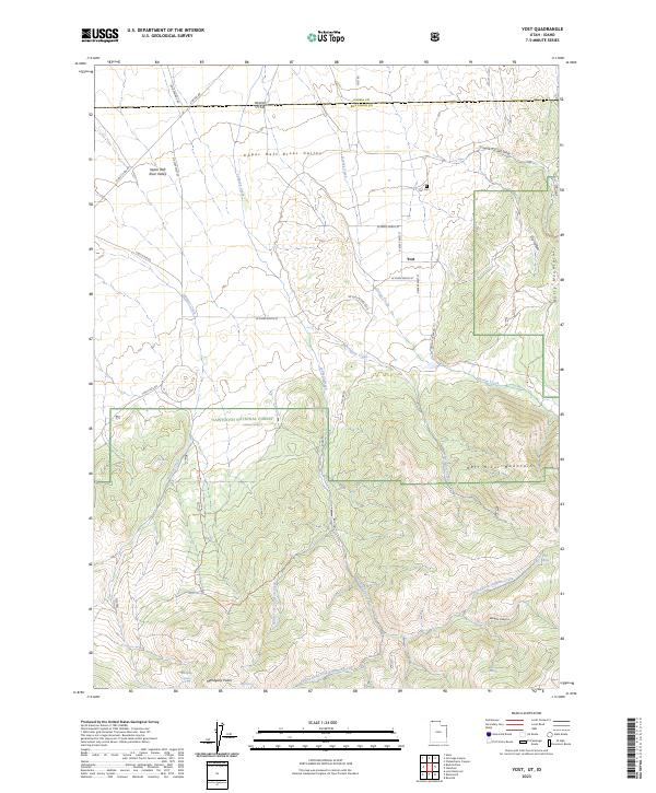
2023 Map of Yost
USGS Topo · Published 2023About this map
Yost sits at the northern edge of the Raft River Mountains on this borderland survey where Utah meets Idaho. The settlement is positioned in the Upper Raft River Valley, a landscape defined by high-elevation drainages such as George Creek and Johnson Creek. To the south, the terrain rises sharply into the Sawtooth National Forest, reaching the heights of Mahogany Peaks and the prominence of Bally Mountain.
Find a feature on this map
43 named features on this map. Tap any name to fly to it.
Don’t see what you’re looking for? This feature index may not catch every label — zoom into the map to look around manually.
Map Details
Editions of this 2023 Yost Map
This is the sole edition of this map. No revisions or reprints were ever made.
Other maps of this area

1954 · Pocatello
USGS Topo · 1:250,000

1954 · Brigham City
USGS Topo · 1:250,000

1958 · Pocatello
USGS Topo · 1:250,000

1958 · Brigham City
USGS Topo · 1:250,000

1959 · Park Valley
USGS Topo · 1:62,500

1959 · Yost
USGS Topo · 1:62,500

1962 · Brigham City
USGS Topo · 1:250,000

1968 · Almo
USGS Topo · 1:24,000

1968 · Jim Sage Canyon
USGS Topo · 1:24,000

1968 · Chokecherry Canyon
USGS Topo · 1:24,000