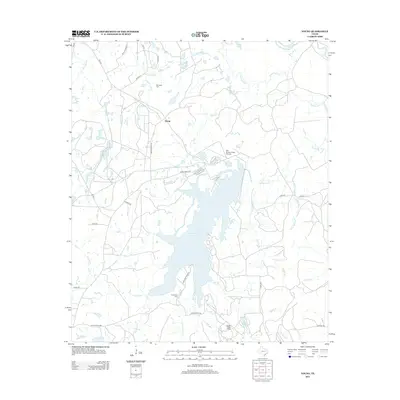
2013 Map of Young
USGS Topo · Published 2013About this map
Young and the surrounding Freestone County countryside are defined by a complex network of waterways feeding into Fairfield Lake. This 2013 survey illustrates the local topography where the Trinity River curves through the northeast corner, joined by tributaries such as Tehuacana Cr and Big Brown Cr. The landscape is a mix of agricultural tracts and water management features, including several smaller lakes like Couch Lake and Timber Lake. For those researching family history or local landmarks, the map identifies specific points of interest like the Rehobath Cem and Chancellor Cem. Transportation and infrastructure are well-documented through a web of ranch roads and farm-to-market routes, alongside specialized sites such as the Big Brown Creek Airstrip and the curiously named Hodge Podge Lodge near the southern boundary.
Find a feature on this map
44 named features on this map. Tap any name to fly to it.
Don’t see what you’re looking for? This feature index may not catch every label — zoom into the map to look around manually.
Map Details
Editions of this 2013 Young Map
This is the sole edition of this map. No revisions or reprints were ever made.
Other maps of this area

1919 · Fairfield
USGS Topo · 1:62,500

1949 · Tennessee Colony
USGS Topo · 1:62,500

1950 · Tennessee Colony
USGS Topo · 1:62,500

1953 · Palestine
USGS Topo · 1:250,000

1954 · Waco
USGS Topo · 1:250,000

1955 · Waco
USGS Topo · 1:250,000

1957 · Palestine
USGS Topo · 1:250,000

1960 · Winkler
USGS Topo · 1:24,000

1960 · Roustabout Camp
USGS Topo · 1:24,000

1961 · Young
USGS Topo · 1:24,000