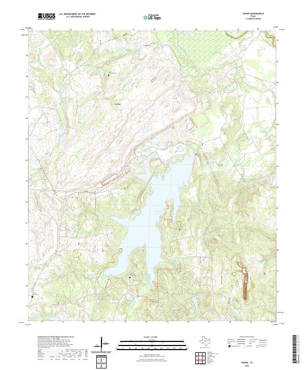
2022 Map of Young
USGS Topo · Published 2022About this map
The community of Young and the extensive waters of Fairfield Lake characterize this part of Freestone County, Texas. This area is defined by a dense network of tributaries including Tehuacana Cr and Big Brown Cr, which flow through a landscape marked by scattered rural homesteads and local cemeteries. Genealogists will find the locations of Rehoboth Cem in the north and both Chancellor Union Cem and Hickory Grove Cem in the south, providing clear points of reference for family histories in the region. Recreational and ecological interest is concentrated around the lake and its surrounding state park lands, where the Nature Trl and The Dockery Trl wind along the shoreline. In the northern reaches, the wetlands of Timberlake suggest the low-lying, riparian character of the terrain before it meets the Anderson Co line.
Find a feature on this map
42 named features on this map. Tap any name to fly to it.
Don’t see what you’re looking for? This feature index may not catch every label — zoom into the map to look around manually.
Map Details
Editions of this 2022 Young Map
This is the sole edition of this map. No revisions or reprints were ever made.
Other maps of this area

1919 · Fairfield
USGS Topo · 1:62,500

1949 · Tennessee Colony
USGS Topo · 1:62,500

1950 · Tennessee Colony
USGS Topo · 1:62,500

1953 · Palestine
USGS Topo · 1:250,000

1954 · Waco
USGS Topo · 1:250,000

1955 · Waco
USGS Topo · 1:250,000

1957 · Palestine
USGS Topo · 1:250,000

1960 · Winkler
USGS Topo · 1:24,000

1960 · Roustabout Camp
USGS Topo · 1:24,000

1961 · Young
USGS Topo · 1:24,000