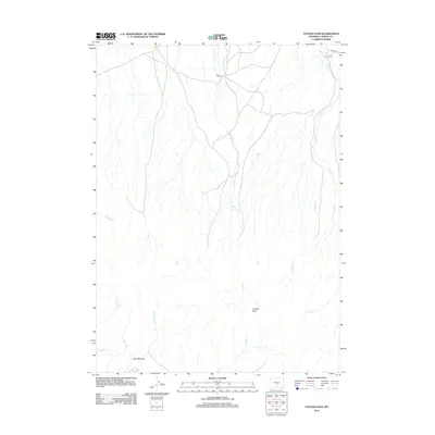
2012 Map of Youngs Pass
USGS Topo · Published 2012About this map
Youngs Pass and the surrounding high country of Carbon County define this landscape of seasonal drainages and remote ranching outposts. The terrain is characterized by a dense network of intermittent watercourses, including Whiskey Cr and Currant Cr, which flow toward the southern meadows. These water sources historically supported cattle operations like the Bar V Ranch and Bar II Ranch near the northern boundary. The southern portion of the map centers on Hays Meadow, a significant open area where Indian Cr and Birch Cr converge. Transportation in this part of Wyoming remains sparse, anchored by Co Rd 489 in the northeast, reflecting a landscape where land use is dictated by the availability of water and navigable passes through the ridges.
Find a feature on this map
14 named features on this map. Tap any name to fly to it.
Don’t see what you’re looking for? This feature index may not catch every label — zoom into the map to look around manually.
Map Details
Editions of this 2012 Youngs Pass Map
This is the sole edition of this map. No revisions or reprints were ever made.
Other maps of this area

1951 · Savage Peak
USGS Topo · 1:24,000

1951 · Bucklin Reservoirs
USGS Topo · 1:24,000

1951 · Independence Rock
USGS Topo · 1:24,000

1953 · Ferris
USGS Topo · 1:24,000

1953 · Spanish Mine
USGS Topo · 1:24,000

1955 · Casper
USGS Topo · 1:250,000

1958 · Casper
USGS Topo · 1:250,000

1961 · Lamont NE
USGS Topo · 1:24,000

1961 · Lamont
USGS Topo · 1:24,000

1962 · Casper
USGS Topo · 1:250,000