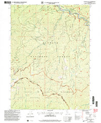
2001 Map of Youngs Peak
USGS Topo · Published 2004About this map
Knownothing Mine and Wolverine Mine sit within a high-altitude landscape defined by the drainage of Knownothing Creek and the South Fork Salmon River. This area of the Klamath National Forest is marked by a deep history of resource extraction, with numerous sites such as the Gilla Mine and Brooks Mine scattered across the steep terrain of the Salmon Alps Mountain Wilderness. Settlement patterns are sparse, with tiny outposts like Missouri Bar and Shingle Flat situated along the riverbanks, likely remnants of early mining activity. High peaks like Youngs Peak and Bowerman Peak rise above a network of gulches and creeks, including Hotelling Gulch and Poverty Gulch, which once supported the water needs of local mining operations. The map also records the presence of the Barton Cabin and a Flume near Blackberry Creek, offering clues to the isolated living conditions of this remote mountain district.
Find a feature on this map
54 named features on this map. Tap any name to fly to it.
Don’t see what you’re looking for? This feature index may not catch every label — zoom into the map to look around manually.
Map Details
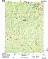
Editions of this 2001 Youngs Peak Map
2 editions found
Other maps of this area

1948 · Weed
USGS Topo · 1:250,000

1950 · Weed
USGS Topo · 1:250,000

1955 · Salmon Mtn
USGS Topo · 1:62,500

1955 · Cecilville
USGS Topo · 1:62,500

1955 · Sawyers Bar
USGS Topo · 1:62,500

1955 · Forks of Salmon
USGS Topo · 1:62,500

1958 · Weed
USGS Topo · 1:250,000

1963 · Weed
USGS Topo · 1:250,000

1974 · Orleans Mtn.
USGS Topo · 1:24,000
1978 · Cecilville
USGS Topo · 1:24,000