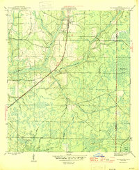
1945 Map of Youngstown
USGS Topo · Published 1945About this map
Youngstown and the surrounding piney flatwoods of northern Bay County are depicted here during the mid-1940s. This interior Florida landscape is defined by an extensive network of wetlands and seasonal drainages, including the expansive Bearthick Swamp and Green Bay Swamp. Human settlement is concentrated along the Atlanta and St Andrews Bay railroad line, which links the small communities of Nixon and Cairo.
Find a feature on this map
28 named features on this map. Tap any name to fly to it.
Don’t see what you’re looking for? This feature index may not catch every label — zoom into the map to look around manually.
Map Details
Editions of this 1945 Youngstown Map
3 editions found
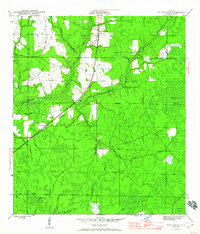
Other maps of this area

1944 · Bayhead
USGS Topo · 1:24,000

1944 · Bennett
USGS Topo · 1:24,000

1945 · Juniper Creek
USGS Topo · 1:31,680

1945 · Youngstown
USGS Topo · 1:31,680

1945 · Bennett
USGS Topo · 1:31,680

1945 · Bayhead
USGS Topo · 1:31,680

1945 · Broad Branch
USGS Topo · 1:31,680

1945 · North Of Allanton
USGS Topo · 1:31,680

1945 · Fountain
USGS Topo · 1:31,680

1945 · Tenmile Swamp
USGS Topo · 1:31,680