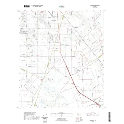
2020 Map of Youngsville
USGS Topo · Published 2020About this map
Youngsville and Broussard anchor this modern survey of the Acadiana region, where the prairie landscape is intricately divided by a network of coulees and bayous. The map captures the suburban expansion of Lafayette Parish into historic agricultural lands, marked by the dense residential developments along Ambassador Caffery Pkwy and Fortune Rd. This transition from rural to residential is punctuated by several longstanding spiritual and community sites, including Saint Anne Catholic Cem and Pleasant Hill Baptist Cem in the west, and Our Lady of Prompt Succor Cem in the settlement of Coteau.
Find a feature on this map
199 named features on this map. Tap any name to fly to it.
Don’t see what you’re looking for? This feature index may not catch every label — zoom into the map to look around manually.
Map Details
Editions of this 2020 Youngsville Map
This is the sole edition of this map. No revisions or reprints were ever made.
Other maps of this area

1932 · Abbeville NE
USGS Topo · 1:31,680

1937 · Derouen
USGS Topo · 1:62,500

1939 · St. Martinsville
USGS Topo · 1:62,500

1945 · New Orleans
USGS Topo · 1:250,000

1946 · Milton
USGS Topo · 1:31,680

1946 · Lafayette
USGS Topo · 1:31,680

1952 · Lake Charles
USGS Topo · 1:250,000

1954 · Lafayette
USGS Topo · 1:31,680
1954 · Milton
USGS Topo · 1:31,680

1954 · Port Arthur
USGS Topo · 1:250,000