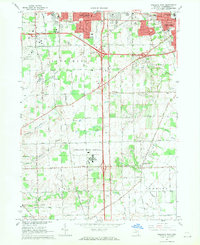
1967 Map of Ypsilanti West
USGS Topo · Published 1969About this map
The Ypsilanti State Hospital complex dominates the southern landscape of this mid-1960s survey, a massive institutional campus that once functioned as a self-contained community. The era's expanding highway infrastructure is evident where new interchanges cut through the townships of Pittsfield, York, and Augusta, bridging the gap between the university city of Ann Arbor and the industrial hub of Ypsilanti. Despite the growing residential subdivisions, particularly near Buhr Park and Burns Park, much of the area remains rural with numerous family-named roads like Begole Road and Talladay Road. The map documents a diverse mix of land uses, from the Ann Arbor Municipal Airport and a Drive-in Theater to several active local schools including Stone Sch and Meadowview Sch. Numerous drains and creeks, such as Warner Creek and Stony Creek, trace the natural hydrology of the Washtenaw County terrain before more intensive modern development arrived.
Find a feature on this map
53 named features on this map. Tap any name to fly to it.
Don’t see what you’re looking for? This feature index may not catch every label — zoom into the map to look around manually.
Map Details
Editions of this 1967 Ypsilanti West Map
4 editions found
Other maps of this area

1902 · South Lyon
USGS Topo · 1:62,500

1902 · Ypsilanti
USGS Topo · 1:62,500

1902 · Dexter
USGS Topo · 1:62,500

1904 · Ann Arbor
USGS Topo · 1:125,000

1906 · Ypsilanti
USGS Topo · 1:62,500

1906 · Dexter
USGS Topo · 1:62,500

1906 · Saline
USGS Topo · 1:62,500

1906 · South Lyon
USGS Topo · 1:62,500

1908 · Ann Arbor
USGS Topo · 1:125,000
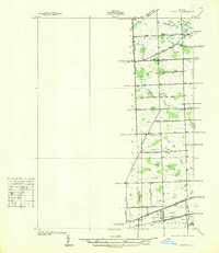
1936 · Denton
USGS Topo · 1:31,680
Featured Places
- Ann Arbor, MI
- Ypsilanti Charter Township, MI
- Pittsfield Charter Township, MI
- Ypsilanti, MI
- York Charter Township, MI