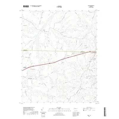
2019 Map of Yuma
USGS Topo · Published 2019About this map
The Big Sandy River and its numerous tributaries dominate this part of West Tennessee, where the Carroll Co Henderson Co border divides a landscape of small settlements and family burial grounds. Modern transit corridors cross the terrain at Parker's Crossroads, yet the map reveals a deep network of older rural routes like Wildersville Rd and Yuma Rd. Genealogical interest is high here, with many family-named cemeteries such as Enochs Cem, Lovell Cem, and Cain Cem scattered across the hills near Wildersville and Yuma. Significant geological features are also present, notably the Fairview Gullies near the eastern edge and the varied drainage basins of Dabbs Cr and Morris Cr. This survey captures the rural character of the region, where legacy farm roads like Old Texas Ln and Old Exchange Rd persist alongside newer infrastructure.
Find a feature on this map
98 named features on this map. Tap any name to fly to it.
Don’t see what you’re looking for? This feature index may not catch every label — zoom into the map to look around manually.
Map Details
Editions of this 2019 Yuma Map
This is the sole edition of this map. No revisions or reprints were ever made.
Other maps of this area

1936 · Clarksburg
USGS Topo · 1:24,000

1936 · Lexington
USGS Topo · 1:24,000

1936 · Yuma
USGS Topo · 1:24,000

1936 · Parsons
USGS Topo · 1:24,000

1936 · Seventeen Creek
USGS Topo · 1:24,000

1936 · Center Ridge
USGS Topo · 1:24,000

1936 · Cavvia
USGS Topo · 1:24,000

1936 · Buena Vista
USGS Topo · 1:24,000

1936 · Chesterfield
USGS Topo · 1:24,000

1950 · Yuma
USGS Topo · 1:24,000