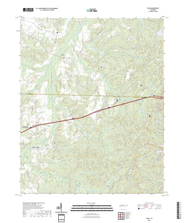
2022 Map of Yuma
USGS Topo · Published 2022About this map
The Big Sandy River and its intricate network of tributaries like Bacon Cr and Morris Cr define this landscape along the border of Carroll Co and Henderson Co. In the northern reaches, the community of Yuma sits near the headwaters of the river, where early road networks like Old School House Rd and Enoch Rd connected family farms and small settlements. The area is heavily marked by its genealogical landscape, containing numerous burial grounds such as Enochs Cem, New Hope Cem, and Wilson Cem that indicate long-standing family ties to the land.
Find a feature on this map
93 named features on this map. Tap any name to fly to it.
Don’t see what you’re looking for? This feature index may not catch every label — zoom into the map to look around manually.
Map Details
Editions of this 2022 Yuma Map
This is the sole edition of this map. No revisions or reprints were ever made.
Other maps of this area

1936 · Clarksburg
USGS Topo · 1:24,000

1936 · Lexington
USGS Topo · 1:24,000

1936 · Yuma
USGS Topo · 1:24,000

1936 · Parsons
USGS Topo · 1:24,000

1936 · Seventeen Creek
USGS Topo · 1:24,000

1936 · Center Ridge
USGS Topo · 1:24,000

1936 · Cavvia
USGS Topo · 1:24,000

1936 · Buena Vista
USGS Topo · 1:24,000

1936 · Chesterfield
USGS Topo · 1:24,000

1950 · Yuma
USGS Topo · 1:24,000