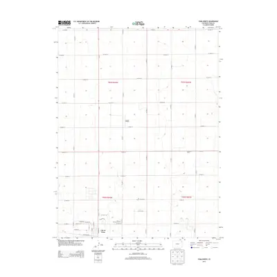
2013 Map of Yuma North
USGS Topo · Published 2013About this map
The City of Yuma anchors the southern edge of this Colorado high plains landscape, showing the organized grid of a regional agricultural hub. The township and range system is starkly visible through a regular network of rural routes, including CO Road 47 and CO Road E, which carve the prairie into predictable sections. Local history is etched into the landscape at the Yuma Municipal Cem and along Old Post Rd, while the presence of the Jackson Airfield and specialized sites like Fifty-Five Farms reflect the modern infrastructure of this rural corner. The survey also captures the B 7 Ranch, illustrating the continued importance of ranching and farming operations in this part of Yuma County.
Find a feature on this map
35 named features on this map. Tap any name to fly to it.
Don’t see what you’re looking for? This feature index may not catch every label — zoom into the map to look around manually.
Map Details
Editions of this 2013 Yuma North Map
This is the sole edition of this map. No revisions or reprints were ever made.
Other maps of this area

1954 · Sterling
USGS Topo · 1:250,000

1958 · Sterling
USGS Topo · 1:250,000

1969 · Schramm
USGS Topo · 1:24,000

1971 · Yuma NE
USGS Topo · 1:24,000

1971 · Clarkville SE
USGS Topo · 1:24,000

1972 · Hyde
USGS Topo · 1:24,000

1972 · Lone Star
USGS Topo · 1:24,000

1972 · Clarkville SW
USGS Topo · 1:24,000

1972 · Otis SE
USGS Topo · 1:24,000

1972 · Yuma South
USGS Topo · 1:24,000