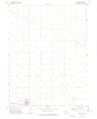
1972 Map of Yuma North
USGS Topo · Published 1975About this map
Yuma serves as the focal point of this Eastern Colorado landscape in the early 1970s, situated at the intersection of agricultural utility and growing community infrastructure. The town's southern edge is defined by the Burlington Northern rail line, which borders local landmarks like the town Park, the Fairground, and a Golf Course. These features suggest a settled regional hub, providing recreation and social space for the surrounding farming community.
Find a feature on this map
15 named features on this map. Tap any name to fly to it.
Don’t see what you’re looking for? This feature index may not catch every label — zoom into the map to look around manually.
Map Details
Editions of this 1972 Yuma North Map
This is the sole edition of this map. No revisions or reprints were ever made.
Other maps of this area

1954 · Sterling
USGS Topo · 1:250,000

1958 · Sterling
USGS Topo · 1:250,000

1969 · Schramm
USGS Topo · 1:24,000

1971 · Yuma NE
USGS Topo · 1:24,000

1971 · Clarkville SE
USGS Topo · 1:24,000

1972 · Hyde
USGS Topo · 1:24,000

1972 · Lone Star
USGS Topo · 1:24,000

1972 · Clarkville SW
USGS Topo · 1:24,000

1972 · Otis SE
USGS Topo · 1:24,000

1972 · Yuma South
USGS Topo · 1:24,000