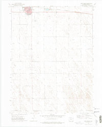
1972 Map of Yuma South
USGS Topo · Published 1975About this map
Yuma serves as the focal point of this Eastern Colorado landscape in the early 1970s, anchoring a region defined by its agricultural and transportation infrastructure. The town's layout is meticulously detailed, showing the civic core including the Hosp, Jr High Sch, and High Sch. The Burlington Northern railroad runs east-west across the northern edge of the sheet, providing the primary connection for the area's commerce. North of the town center, Lake Yuma and the Sewage Disposal Ponds mark the local water management, while the Municipal Airport to the south reflects the region's aerial connectivity. The surrounding terrain is primarily defined by its topographic undulations and agricultural parcels, with the Base Line running along the southern border. This survey documents the transition of a high plains community as it balanced established rail-dependent roots with expanding municipal services.
Find a feature on this map
14 named features on this map. Tap any name to fly to it.
Don’t see what you’re looking for? This feature index may not catch every label — zoom into the map to look around manually.
Map Details
Editions of this 1972 Yuma South Map
4 editions found


Other maps of this area

1954 · Limon
USGS Topo · 1:250,000

1954 · Sterling
USGS Topo · 1:250,000

1957 · Limon
USGS Topo · 1:250,000

1958 · Limon
USGS Topo · 1:250,000

1958 · Sterling
USGS Topo · 1:250,000

1969 · Heartstrong
USGS Topo · 1:24,000

1969 · Schramm
USGS Topo · 1:24,000

1971 · Yuma NE
USGS Topo · 1:24,000

1972 · Hyde
USGS Topo · 1:24,000

1972 · Otis SE
USGS Topo · 1:24,000