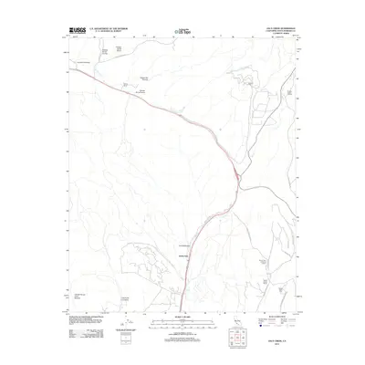
2012 Map of Zaca Creek
USGS Topo · Published 2012About this map
Jonata Park and the legacy of Spanish land grants anchor this part of Santa Barbara County, where the landscape is defined by its seasonal creeks and deep canyons. The map details several historic holdings, including Rancho San Carlos de Jonata and Rancho Santa Ynez, reflecting the area's transition from early ranching roots to modern viticulture and energy production. Evidence of industry is found at the Zaca Oil Field to the northeast, while the local economy's agricultural evolution is marked by the Ballard Canyon Winery. The terrain is deeply carved by drainage systems such as Zaca Cr and San Antonio Cr, which run through named geographic features like Cañada de los Alisos and Cañada de los Coches. This layout of road networks and land divisions reveals how 21st-century development follows the original topography of the Los Alamos Valley.
Find a feature on this map
27 named features on this map. Tap any name to fly to it.
Don’t see what you’re looking for? This feature index may not catch every label — zoom into the map to look around manually.
Map Details
Editions of this 2012 Zaca Creek Map
This is the sole edition of this map. No revisions or reprints were ever made.
Other maps of this area

1905 · Lompoc
USGS Topo · 1:125,000

1942 · Lompoc
USGS Topo · 1:125,000

1942 · Lompoc
USGS Topo · 1:62,500

1942 · Santa Maria
USGS Topo · 1:62,500

1942 · Tepusquet Peak
USGS Topo · 1:62,500

1942 · Los Olivos
USGS Topo · 1:62,500

1943 · Los Olivos
USGS Topo · 1:62,500

1943 · Tepusquet Peak
USGS Topo · 1:62,500

1943 · Lompoc
USGS Topo · 1:125,000

1947 · Careaga Canyon
USGS Topo · 1:24,000