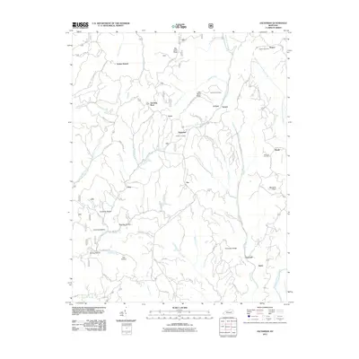
2011 Map of Zachariah
USGS Topo · Published 2011About this map
Zachariah and its neighboring Kentucky hamlets define this landscape at the intersection of the Middle Fork Red River and Walker Creek. The terrain is deeply etched by a network of drainage systems, including Hell Creek, Crystal Creek, and the curiously named Hell for Certain Creek. These watercourses carve through high ground like Big Bend Ridge and Shumaker Ridge, creating the numerous hollows that characterize local geography, such as Coalbank Hollow and Hog Gap Hollow.
Find a feature on this map
80 named features on this map. Tap any name to fly to it.
Don’t see what you’re looking for? This feature index may not catch every label — zoom into the map to look around manually.
Map Details
Editions of this 2011 Zachariah Map
This is the sole edition of this map. No revisions or reprints were ever made.
Other maps of this area

1892 · Beattyville
USGS Topo · 1:125,000

1951 · Pomeroyton
USGS Topo · 1:24,000

1952 · Stanton
USGS Topo · 1:24,000

1952 · Slade
USGS Topo · 1:24,000

1952 · Tallega
USGS Topo · 1:24,000

1952 · Beattyville
USGS Topo · 1:24,000

1952 · Cobhill
USGS Topo · 1:24,000
1952 · Campton
USGS Topo · 1:24,000

1952 · Heidelberg
USGS Topo · 1:24,000

1953 · Zachariah
USGS Topo · 1:24,000