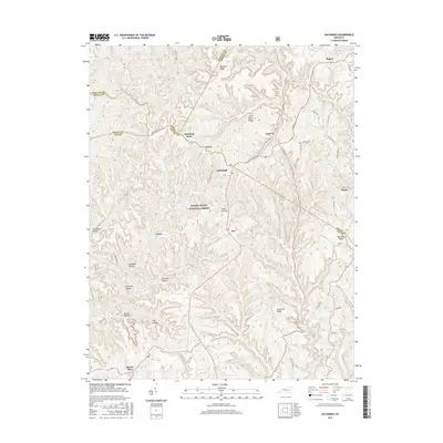
2016 Map of Zachariah
USGS Topo · Published 2016About this map
Daniel Boone National Forest occupies the core of this landscape where Powell, Estill, Wolfe, and Lee counties converge. Small settlements like Zachariah and Standing Rock are interconnected by winding ridge-top roads such as Fincastle Rd and Shumaker Ridge Rd. The terrain is characterized by a dense network of hollows, including Coalbank Hollow, Hog Gap Hollow, and Spring Hollow, which feed into local waterways like Zachariah Fork.
Find a feature on this map
43 named features on this map. Tap any name to fly to it.
Don’t see what you’re looking for? This feature index may not catch every label — zoom into the map to look around manually.
Map Details
Editions of this 2016 Zachariah Map
This is the sole edition of this map. No revisions or reprints were ever made.
Other maps of this area

1892 · Beattyville
USGS Topo · 1:125,000

1951 · Pomeroyton
USGS Topo · 1:24,000

1952 · Stanton
USGS Topo · 1:24,000

1952 · Slade
USGS Topo · 1:24,000

1952 · Tallega
USGS Topo · 1:24,000

1952 · Beattyville
USGS Topo · 1:24,000

1952 · Cobhill
USGS Topo · 1:24,000
1952 · Campton
USGS Topo · 1:24,000

1952 · Heidelberg
USGS Topo · 1:24,000

1953 · Zachariah
USGS Topo · 1:24,000