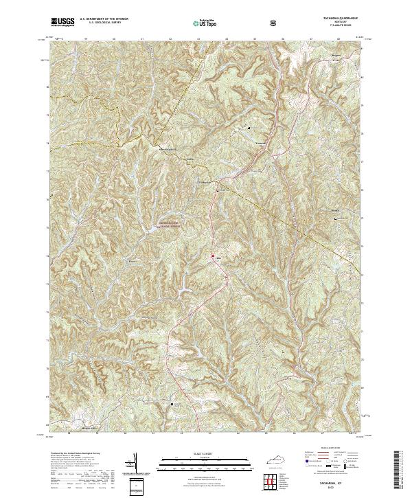
2022 Map of Zachariah
USGS Topo · Published 2022About this map
Daniel Boone National Forest dominates this section of Lee and surrounding counties, where the Middle Fork Red River carves through a landscape defined by prominent ridges and deep hollows. The settlement pattern follows these high grounds and narrow drainages, with Zachariah and Leeco serving as local anchors along the central ridge lines. The geography is characterized by intricate water systems such as Big Sinking Cr and Sand Lick Fork, illustrating the difficult terrain that historically shaped movement through this part of Kentucky.
Find a feature on this map
74 named features on this map. Tap any name to fly to it.
Don’t see what you’re looking for? This feature index may not catch every label — zoom into the map to look around manually.
Map Details
Editions of this 2022 Zachariah Map
This is the sole edition of this map. No revisions or reprints were ever made.
Other maps of this area

1892 · Beattyville
USGS Topo · 1:125,000

1951 · Pomeroyton
USGS Topo · 1:24,000

1952 · Stanton
USGS Topo · 1:24,000

1952 · Slade
USGS Topo · 1:24,000

1952 · Tallega
USGS Topo · 1:24,000

1952 · Beattyville
USGS Topo · 1:24,000

1952 · Cobhill
USGS Topo · 1:24,000
1952 · Campton
USGS Topo · 1:24,000

1952 · Heidelberg
USGS Topo · 1:24,000

1953 · Zachariah
USGS Topo · 1:24,000