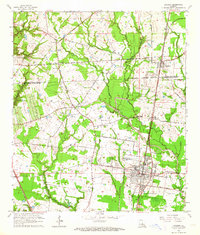
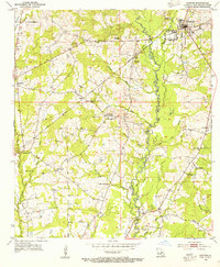
1963 Map of Zachary
USGS Topo · Published 1964About this map
Zachary serves as a central hub in this mid-century survey of the East Feliciana Parish and East Baton Rouge Parish boundary. The Illinois Central railroad dictates the local development pattern, linking the towns of Slaughter, Plains, and Lindsay. The landscape is a mix of small rural communities and emerging industrial footprints, evidenced by the Alsen Oil Field in the south. Local life is anchored by a dense network of country churches and family burial grounds, including Pleasant Grove Ch, Goodhope Ch, and Stanford Cem. Institutional growth is visible at the Northwestern High Sch and Lane Memorial Hospital, while the natural drainage of White Bayou and Cypress Bayou winds through the parish lines, defining the topography between these established settlements.
Find a feature on this map
33 named features on this map. Tap any name to fly to it.
Don’t see what you’re looking for? This feature index may not catch every label — zoom into the map to look around manually.
Map Details
Editions of this 1963 Zachary Map
4 editions found
Other maps of this area

1906 · Bayou Sara
USGS Topo · 1:125,000

1939 · St. Francisville
USGS Topo · 1:62,500

1939 · Zachary
USGS Topo · 1:62,500

1945 · Jackson
USGS Topo · 1:31,680

1946 · Clinton
USGS Topo · 1:31,680

1953 · Comite
USGS Topo · 1:24,000

1954 · Zachary
USGS Topo · 1:24,000

1954 · Port Hudson
USGS Topo · 1:24,000
1954 · Clinton
USGS Topo · 1:24,000

1954 · Walls
USGS Topo · 1:24,000