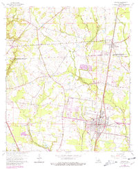
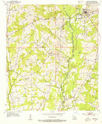
1963 Map of Zachary
USGS Topo · Published 1981About this map
The Illinois Central Railroad corridor anchors the development of northern East Baton Rouge Parish in the early 1960s, connecting the established hubs of Zachary and Slaughter. This era shows a landscape where rural tradition and emerging infrastructure meet, with numerous small community anchors such as Poplar Springs Ch and Olive Grove Ch dotting the countryside. The presence of the Alsen Oil Field and scattered pits suggest a transition toward resource extraction alongside the region's agricultural roots.
Find a feature on this map
40 named features on this map. Tap any name to fly to it.
Don’t see what you’re looking for? This feature index may not catch every label — zoom into the map to look around manually.
Map Details
Editions of this 1963 Zachary Map
4 editions found
Other maps of this area

1906 · Bayou Sara
USGS Topo · 1:125,000

1939 · St. Francisville
USGS Topo · 1:62,500

1939 · Zachary
USGS Topo · 1:62,500

1945 · Jackson
USGS Topo · 1:31,680

1946 · Clinton
USGS Topo · 1:31,680

1953 · Comite
USGS Topo · 1:24,000

1954 · Zachary
USGS Topo · 1:24,000

1954 · Port Hudson
USGS Topo · 1:24,000
1954 · Clinton
USGS Topo · 1:24,000

1954 · Walls
USGS Topo · 1:24,000