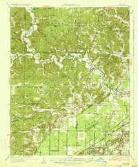
1935 Map of Zalma
USGS Topo · Published 1935About this map
The Castor River defines the rugged geography of this 1935 survey, winding through the hills of Bollinger and Wayne Counties before reaching the managed drainage of the southern lowlands. Around the community of Zalma, the landscape is a dense network of upland farms, marked by an exceptional number of local schools such as Patterson Sch and Baker Sch, and country churches including Antioch Ch. This era represents a significant transition in land use, as the northern ridges give way to the engineered landscape of the south, where Duck Creek and an extensive system of man-made channels like Ditch No 104 began to reclaim the swampy terrain for agriculture.
Find a feature on this map
100 named features on this map. Tap any name to fly to it.
Don’t see what you’re looking for? This feature index may not catch every label — zoom into the map to look around manually.
Map Details
Editions of this 1935 Zalma Map
3 editions found
Other maps of this area

1930 · Coldwater
USGS Topo · 1:62,500

1933 · Marble Hill
USGS Topo · 1:62,500

1933 · Marquand
USGS Topo · 1:62,500

1934 · Greenville
USGS Topo · 1:62,500

1934 · Bloomfield
USGS Topo · 1:62,500

1934 · Advance
USGS Topo · 1:62,500

1934 · Puxico
USGS Topo · 1:62,500

1935 · Poplar Bluff
USGS Topo · 1:62,500

1935 · Zalma
USGS Topo · 1:62,500

1937 · Marble Hill
USGS Topo · 1:62,500