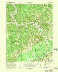
1939 Map of Zalma
USGS Topo · Published 1958About this map
Castor River meanders through the heart of this landscape, marking a transition from the wooded hills of Upper Bollinger County to the engineered lowlands of the Valley Division. The 1930s terrain is characterized by a dense network of family-centered landmarks, including numerous rural schools like Snake Bluff School No 2 and Cane Creek Sch, alongside local spiritual centers such as Pleasant Valley Ch and Abernathy Chapel.
Find a feature on this map
95 named features on this map. Tap any name to fly to it.
Don’t see what you’re looking for? This feature index may not catch every label — zoom into the map to look around manually.
Map Details
Editions of this 1939 Zalma Map
2 editions found

Other maps of this area

1930 · Coldwater
USGS Topo · 1:62,500

1933 · Marble Hill
USGS Topo · 1:62,500

1933 · Marquand
USGS Topo · 1:62,500

1934 · Greenville
USGS Topo · 1:62,500

1934 · Bloomfield
USGS Topo · 1:62,500

1934 · Advance
USGS Topo · 1:62,500

1934 · Puxico
USGS Topo · 1:62,500

1935 · Poplar Bluff
USGS Topo · 1:62,500

1935 · Zalma
USGS Topo · 1:62,500

1937 · Marble Hill
USGS Topo · 1:62,500